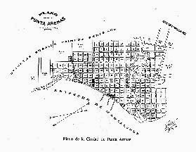
Punta Arenas
City Plan, 1907
Punta Arenas (located on the Strait
of Magellan) was the first town of economic importance to be developed
in the region. Before the opening of the Panama Canal, many inter-oceanic
vessels called there, before continuing their voyage northwards.
This city plan (showing the original street names) was prepared
when the population had already passed the 10,000 mark.